
8/22/11 Day 17- On the road again... Barney, Mark and Kathy took off about 8 am from Stacey's. We had to say good bye and move on with our journey. Thanks for the great time in Colorado! On to Hiway 285 through some more mountains towards Gunnison we went. Over Kenosha Pass at 10,001 feet and then Red Hill Pass at 9,993 feet. There were nice roads, beautiful mountain sides and wildflowers. With each turn we would open our mouths in awe.

Stopped in Buena Vista for roadside hamburgers and chili then back south on 285 towards Poncha Springs. The Sawatch Range includes the Collegiate Peaks aptly named Mt. Princeton, Yale and Harvard. They top out at 14000 plus feet.

Turning west on 50 Monarch Pass was our highest one at 11,312 feet! This was our last crossing of the Continental Divide on this trip!

We dropped down to 5,400 ft. elevation in Gunnison and called it a night at the KOA. This is the gateway area to the Gunnison National Forest and the Curecanti National Recreation area. Barney got to enjoy our yummy fried spam and cheese sandwiches for dinner! We had a nice night around the campfire and listened to stories from the neighboring Harley riders from Montana!

An evening stroll took us down to the Gunnison River only about 1/4 mile from our campground. The river rafters were pulling there rafts out across from us. It was tempting to stay another night and do some rafting tomorrow but the Black Canyon calls instead!

8/23/11 Day 18- Curecanti National Recreational Area. There are 3 reservoirs formed by dams on the Gunnison River- the Blue Mesa, Morrow Point and Crystal. Water sports are a big attraction here as well as trout fishing, camping and hiking. It was a great ride in to Montrose.

Cimmaron, a classic little one stop shop town! We attempted to buy gas but they didn't have premium so it was either pan for gold or on to Montrose so that's what we chose!

The Black Canyon of the Gunnison National Park. Elevations range from 6,500 to 9,040 feet. We took the 14 mile south rim scenic route. We saw some of the deepest portions of the canyon. Some of the Earth's oldest base rocks ( 1.75 billion years old) have been cut by the river to a depth of 2,722 feet. At the top, the narrowest distance between canyon walls is 1,100 feet but at the river it was 40 feet. And yes, we made the journey down on the bikes!

The requisite sign marker of where we were! This is how I keep track of all the thousands of pictures!

Another view from the top of the canyon. You can see the riverbed below.... that is the next adventure.

You can see the warning signs that talk about the East Portal Road down to the river. It is a steep 16% grade of continuous switchbacks down into the canyon. The park ranger let us leave our little motorcycle cargo trailer at the top! No vehicles allowed over 22 feet in length. I don't have any pictures on the way down because of holding still for Mark!

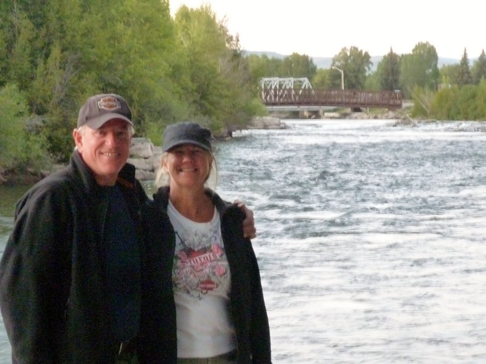
After the "little" trip down we headed down the path to find a place to get out in the river for some cold water to cool off our feet! And boy did it feel good. We even got to see some 6" trout swimming around our little piggy's!

Evidence that we did indeed go to the base of the Black Canyon! Mark, Kathy and Barney on our continuing cousin adventure! Back to Montrose we headed and had a great lunch at a local brew pub. Ask us about the 50/50 burger! Not sure where we will land tonight but are heading south to Ouray. The weather remains warm and dry! Life is good and it has been a great day so far.

 8/22/11 Day 17- On the road again... Barney, Mark and Kathy took off about 8 am from Stacey's. We had to say good bye and move on with our journey. Thanks for the great time in Colorado! On to Hiway 285 through some more mountains towards Gunnison we went. Over Kenosha Pass at 10,001 feet and then Red Hill Pass at 9,993 feet. There were nice roads, beautiful mountain sides and wildflowers. With each turn we would open our mouths in awe.
 Stopped in Buena Vista for roadside hamburgers and chili then back south on 285 towards Poncha Springs. The Sawatch Range includes the Collegiate Peaks aptly named Mt. Princeton, Yale and Harvard. They top out at 14000 plus feet.
 Turning west on 50 Monarch Pass was our highest one at 11,312 feet! This was our last crossing of the Continental Divide on this trip!
 We dropped down to 5,400 ft. elevation in Gunnison and called it a night at the KOA. This is the gateway area to the Gunnison National Forest and the Curecanti National Recreation area. Barney got to enjoy our yummy fried spam and cheese sandwiches for dinner! We had a nice night around the campfire and listened to stories from the neighboring Harley riders from Montana!
 An evening stroll took us down to the Gunnison River only about 1/4 mile from our campground. The river rafters were pulling there rafts out across from us. It was tempting to stay another night and do some rafting tomorrow but the Black Canyon calls instead!
 8/23/11 Day 18- Curecanti National Recreational Area. There are 3 reservoirs formed by dams on the Gunnison River- the Blue Mesa, Morrow Point and Crystal. Water sports are a big attraction here as well as trout fishing, camping and hiking. It was a great ride in to Montrose.
 Cimmaron, a classic little one stop shop town! We attempted to buy gas but they didn't have premium so it was either pan for gold or on to Montrose so that's what we chose!
 The Black Canyon of the Gunnison National Park. Elevations range from 6,500 to 9,040 feet. We took the 14 mile south rim scenic route. We saw some of the deepest portions of the canyon. Some of the Earth's oldest base rocks ( 1.75 billion years old) have been cut by the river to a depth of 2,722 feet. At the top, the narrowest distance between canyon walls is 1,100 feet but at the river it was 40 feet. And yes, we made the journey down on the bikes!
 The requisite sign marker of where we were! This is how I keep track of all the thousands of pictures!
 Another view from the top of the canyon. You can see the riverbed below.... that is the next adventure.
 You can see the warning signs that talk about the East Portal Road down to the river. It is a steep 16% grade of continuous switchbacks down into the canyon. The park ranger let us leave our little motorcycle cargo trailer at the top! No vehicles allowed over 22 feet in length. I don't have any pictures on the way down because of holding still for Mark!
 After the "little" trip down we headed down the path to find a place to get out in the river for some cold water to cool off our feet! And boy did it feel good. We even got to see some 6" trout swimming around our little piggy's!
 Evidence that we did indeed go to the base of the Black Canyon! Mark, Kathy and Barney on our continuing cousin adventure! Back to Montrose we headed and had a great lunch at a local brew pub. Ask us about the 50/50 burger! Not sure where we will land tonight but are heading south to Ouray. The weather remains warm and dry! Life is good and it has been a great day so far.
No comments:
Post a Comment